


Nearby Sites
This was originally built to see if a community project qualified for a grant if it was within 2.5 miles of a listed recycling centre.
Frontend
The user enters a postcode and the system calculates the distance from that postcode to all the ones contained in the database; if the distance falls within the given miles a message is displayed that they meet this part of the criteria and the user can progress. If it falls outside the distance the user is informed that they do not qualify.
This is a sample installation using test data and an active radius of 2.5 miles.
Backend
The backend settings allow the site administrator to control the qualifying distance, default latitude, longitude and zoom level of the map. It also allows for the two Google API key to be saved together with instructions of how to generate the key.
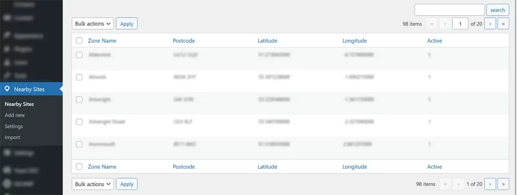
The nearby sites can be imported from a CSV file or manually added. Editing is enabled for each site and there is a toggle to switch each one on or off allowing for temporary deactivation of a site.
Technology
- Google Maps
- Bespoke database tables
- Ajax
Privacy Overview
We also use third-party cookies that help us analyze and understand how you use this website. These cookies will be stored in your browser only with your consent. You also have the option to opt-out of these cookies. But opting out of some of these cookies may have an effect on your browsing experience.
| Cookie | Duration | Description |
|---|---|---|
| ASP.NET_SessionId | session | Issued by Microsoft's ASP.NET Application, this cookie stores session data during a user's website visit. |
| cookielawinfo-checbox-analytics | 11 months | This cookie is set by GDPR Cookie Consent plugin. The cookie is used to store the user consent for the cookies in the category "Analytics". |
| cookielawinfo-checbox-functional | 11 months | The cookie is set by GDPR cookie consent to record the user consent for the cookies in the category "Functional". |
| cookielawinfo-checbox-others | 11 months | This cookie is set by GDPR Cookie Consent plugin. The cookie is used to store the user consent for the cookies in the category "Other. |
| cookielawinfo-checkbox-advertisement | 1 year | Set by the GDPR Cookie Consent plugin, this cookie is used to record the user consent for the cookies in the "Advertisement" category . |
| cookielawinfo-checkbox-analytics | 1 year | Set by the GDPR Cookie Consent plugin, this cookie is used to record the user consent for the cookies in the "Analytics" category . |
| cookielawinfo-checkbox-functional | 1 year | The cookie is set by the GDPR Cookie Consent plugin to record the user consent for the cookies in the category "Functional". |
| cookielawinfo-checkbox-necessary | 11 months | This cookie is set by GDPR Cookie Consent plugin. The cookies is used to store the user consent for the cookies in the category "Necessary". |
| cookielawinfo-checkbox-non-necessary | 1 year | Set by the GDPR Cookie Consent plugin, this cookie is used to record the user consent for the cookies in the "Non-necessary" category . |
| cookielawinfo-checkbox-others | 1 year | Set by the GDPR Cookie Consent plugin, this cookie is used to store the user consent for cookies in the category "Others". |
| cookielawinfo-checkbox-performance | 11 months | This cookie is set by GDPR Cookie Consent plugin. The cookie is used to store the user consent for the cookies in the category "Performance". |
| CookieLawInfoConsent | 1 year | Records the default button state of the corresponding category & the status of CCPA. It works only in coordination with the primary cookie. |
| nlbi_1947674 | session | A load balancing cookie set to ensure requests by a client are sent to the same origin server. |
| OptanonConsent | 1 year | OneTrust sets this cookie to store details about the site's cookie category and check whether visitors have given or withdrawn consent from the use of each category. |
| viewed_cookie_policy | 11 months | The cookie is set by the GDPR Cookie Consent plugin and is used to store whether or not user has consented to the use of cookies. It does not store any personal data. |
| visid_incap_1947674 | 1 year | SiteLock sets this cookie to provide cloud-based website security services. |
| __cfruid | session | Cloudflare sets this cookie to identify trusted web traffic. |
| Cookie | Type | Duration | Description |
|---|---|---|---|
| ASP.NET_SessionId | session | Issued by Microsoft's ASP.NET Application, this cookie stores session data during a user's website visit. | |
| cookielawinfo-checbox-analytics | 0 | 11 months | This cookie is set by GDPR Cookie Consent plugin. The cookie is used to store the user consent for the cookies in the category "Analytics". |
| cookielawinfo-checbox-functional | 0 | 11 months | The cookie is set by GDPR cookie consent to record the user consent for the cookies in the category "Functional". |
| cookielawinfo-checbox-others | 0 | 11 months | This cookie is set by GDPR Cookie Consent plugin. The cookie is used to store the user consent for the cookies in the category "Other. |
| cookielawinfo-checkbox-advertisement | 1 year | Set by the GDPR Cookie Consent plugin, this cookie is used to record the user consent for the cookies in the "Advertisement" category . | |
| cookielawinfo-checkbox-analytics | 1 year | Set by the GDPR Cookie Consent plugin, this cookie is used to record the user consent for the cookies in the "Analytics" category . | |
| cookielawinfo-checkbox-functional | 1 year | The cookie is set by the GDPR Cookie Consent plugin to record the user consent for the cookies in the category "Functional". | |
| cookielawinfo-checkbox-necessary | 0 | 11 months | This cookie is set by GDPR Cookie Consent plugin. The cookies is used to store the user consent for the cookies in the category "Necessary". |
| cookielawinfo-checkbox-non-necessary | 1 year | Set by the GDPR Cookie Consent plugin, this cookie is used to record the user consent for the cookies in the "Non-necessary" category . | |
| cookielawinfo-checkbox-others | 1 year | Set by the GDPR Cookie Consent plugin, this cookie is used to store the user consent for cookies in the category "Others". | |
| cookielawinfo-checkbox-performance | 0 | 11 months | This cookie is set by GDPR Cookie Consent plugin. The cookie is used to store the user consent for the cookies in the category "Performance". |
| CookieLawInfoConsent | 1 year | Records the default button state of the corresponding category & the status of CCPA. It works only in coordination with the primary cookie. | |
| fr | 3 months | Facebook sets this cookie to show relevant advertisements to users by tracking user behaviour across the web, on sites that have Facebook pixel or Facebook social plugin. | |
| incap_ses_1581_1947674 | session | No description | |
| m | 2 years | No description available. | |
| nlbi_1947674 | session | A load balancing cookie set to ensure requests by a client are sent to the same origin server. | |
| OptanonConsent | 1 year | OneTrust sets this cookie to store details about the site's cookie category and check whether visitors have given or withdrawn consent from the use of each category. | |
| viewed_cookie_policy | 0 | 11 months | The cookie is set by the GDPR Cookie Consent plugin and is used to store whether or not user has consented to the use of cookies. It does not store any personal data. |
| visid_incap_1947674 | 1 year | SiteLock sets this cookie to provide cloud-based website security services. | |
| vuid | 2 years | Vimeo installs this cookie to collect tracking information by setting a unique ID to embed videos to the website. | |
| _calendly_session | 21 days | Calendly, a Meeting Schedulers, sets this cookie to allow the meeting scheduler to function within the website and to add events into the visitor’s calendar. | |
| _fbp | 3 months | This cookie is set by Facebook to display advertisements when either on Facebook or on a digital platform powered by Facebook advertising, after visiting the website. | |
| _ga | 2 years | The _ga cookie, installed by Google Analytics, calculates visitor, session and campaign data and also keeps track of site usage for the site's analytics report. The cookie stores information anonymously and assigns a randomly generated number to recognize unique visitors. | |
| _ga Google | Third party | 1 day | Google Analytics tag used to distinguish one user from another |
| _gat Google | Third party | 1 minute | Google Analytics tag. Sometimes appears as _dc_gtm_. |
| _gat_gtag_UA_438243_11 | 1 minute | Set by Google to distinguish users. | |
| _ga_DJG7CT3J6E | 2 years | This cookie is installed by Google Analytics. | |
| _gid | 1 day | Installed by Google Analytics, _gid cookie stores information on how visitors use a website, while also creating an analytics report of the website's performance. Some of the data that are collected include the number of visitors, their source, and the pages they visit anonymously. | |
| _gid Google | Third party | 2 years | Google Analytics tag used to distinguish one user from another |
| __cfruid | session | Cloudflare sets this cookie to identify trusted web traffic. | |
| __cf_bm | 30 minutes | This cookie, set by Cloudflare, is used to support Cloudflare Bot Management. |
| Cookie | Duration | Description |
|---|---|---|
| __cf_bm | 30 minutes | This cookie, set by Cloudflare, is used to support Cloudflare Bot Management. |
| Cookie | Duration | Description |
|---|---|---|
| _calendly_session | 21 days | Calendly, a Meeting Schedulers, sets this cookie to allow the meeting scheduler to function within the website and to add events into the visitor’s calendar. |
| Cookie | Duration | Description |
|---|---|---|
| vuid | 2 years | Vimeo installs this cookie to collect tracking information by setting a unique ID to embed videos to the website. |
| _ga | 2 years | The _ga cookie, installed by Google Analytics, calculates visitor, session and campaign data and also keeps track of site usage for the site's analytics report. The cookie stores information anonymously and assigns a randomly generated number to recognize unique visitors. |
| _gat_gtag_UA_438243_11 | 1 minute | Set by Google to distinguish users. |
| _ga_DJG7CT3J6E | 2 years | This cookie is installed by Google Analytics. |
| _gid | 1 day | Installed by Google Analytics, _gid cookie stores information on how visitors use a website, while also creating an analytics report of the website's performance. Some of the data that are collected include the number of visitors, their source, and the pages they visit anonymously. |
| Cookie | Duration | Description |
|---|---|---|
| fr | 3 months | Facebook sets this cookie to show relevant advertisements to users by tracking user behaviour across the web, on sites that have Facebook pixel or Facebook social plugin. |
| _fbp | 3 months | This cookie is set by Facebook to display advertisements when either on Facebook or on a digital platform powered by Facebook advertising, after visiting the website. |
| Cookie | Duration | Description |
|---|---|---|
| incap_ses_1581_1947674 | session | No description |
| m | 2 years | No description available. |
- Home
- Website creation▼
- Hosting▼
- News▼
- Our latest blog & news posts▼
- Selling Online to Europe? Your Website May Need a New Withdrawal Button by June 2026
- The Skills You Don’t Think You Need (But Actually Do) as a Business Owner
- Why “Set and Forget” Is the Most Expensive Website Strategy
- The Silent Killer of WordPress Websites: Why 75% of Failures Are Totally Preventable
- What Really Goes into Creating a Great Blogging System
- Newsletters
- Website glossary
- Legal requirements for websites in the UK
- Our latest blog & news posts
- FAQ
- About us▼
- Contact us▼
- Training▼
- Website Clarity Report